Our Trip to California — 1999
Getting Underway
Josephine and I left Tucson on October 1st at around 9:45 a.m. — about 15 minutes earlier than we usually get away. Both of us were thankful the entire trip was uneventful with regard to motor home problems. Both air conditioners worked, keeping the inside very comfortable, and the old motor home kept right on humming all the way to San Juan Bautista.
The first day's goal is Barstow, California — a little over halfway. We know that if we can make it to Barstow we'll have a short second day.
Because I have made this trip so many times it has become a chore, so I've divided it into segments, which I kid myself into thinking makes it more interesting and therefore less tiring. If you think of a trip as 900-plus miles, much of it through desert landscape, that's bad news — almost two whole days of driving. But think of it this way: rather than thinking of the entire 900 miles, think of just 60 or maybe 80 or even 100-mile segments and it becomes a piece of cake. Well, maybe not a piece of cake — but 60 miles is only one hour, and we all know one hour isn't that long.
Segment One: Tucson to Casa Grande (60 miles)
The first segment is really just to get us going — we try to become accustomed to the sounds, vibrations, and feel of the motor home. Josephine enjoys being up close and personal with the 18-wheeler drivers. When the motor home passes a semi on her side she is close enough to reach out and touch the driver. She tells everyone she closes her eyes when we pass, especially on mountainous roads. When she gets a little tense from the traffic or road conditions she goes to the back and takes a nap, which helps her greatly.
The heat isn't bad — maybe 95 to 100 degrees. The scenery is a little flat and ho-hum but not terrible. The Palo Verde trees aren't beautiful but they are green, and because of the rain we had that summer, grass and weeds are growing which adds to the greenery. The freeway is clean thanks to Arizona's policy of using prison inmates to pick up debris, and we are paralleling the Southern Pacific Railroad, so I look for trains and think of the good old days when I was working on the railroad.
When we are traveling I think of historical events that occurred along the route — this keeps my mind off the tedium and sometimes makes the time pass more quickly. The first landmark is Picacho Peak, a large 1,500-foot rock monolith just off the freeway. Picacho Peak is where the only battle of the Civil War occurred in Arizona Territory. Union General Carlton was moving troops from California to the eastern theater of war when some Arizona militia troops decided to make a name for themselves. The battle lasted a few minutes, no one was hurt, and each side went their own way.
Just about a mile before Picacho Peak is a farm where they raise emus for their meat. An emu is a large bird the size of an ostrich. I've never tasted emu meat but it is supposed to be good — low in fat and cholesterol. A few years ago a breeding pair of the birds was very expensive; now I think they are much less so. At any rate there is a large farm with somewhere between 100 and 200 birds.
When we get to Casa Grande I always make a routine stop to check out the tow dolly, the car, and do a general walk-around inspection for any obvious problems. Everything checked out and we're on our way again.
Segment Two: Casa Grande to Gila Bend (60 miles)
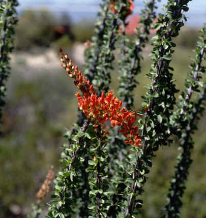
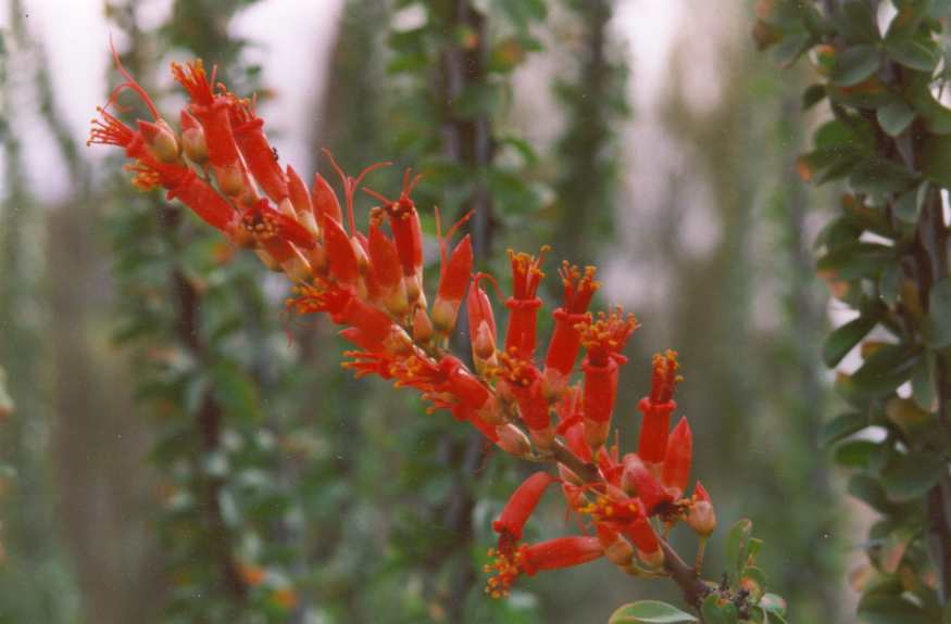
This segment has more hills but the road is quite straight. We leave the railroad and start uphill, gaining about 1,000 feet of altitude. There are many Saguaro cacti through here, some Ocotillo, Palo Verde, and Creosote bush. We need to remember this is the Sonoran Desert. The thermostatically controlled cooling fan for the engine is on most of the time now, increasing the noise level very noticeably — without the fan there isn't that much noise in the motor home, but with it on it sounds like a jet fighter plane.
Most of the route between Tucson and Gila Bend follows where the Butterfield Stage Line once ran. One thing we must remember when considering likely routes for a stage line is the availability of water every thirty or forty miles. Back in the days of the stage lines the Santa Cruz River, which parallels the route for a considerable distance, had water in it year-round. Now the river — which enters the United States from Mexico near Nogales — is dry most of the time. The Gila River was another major year-round water source in those early days, fed by the Rocky Mountains of New Mexico. Now its bed is dry much of the time just west of Phoenix, with most of its water impounded into a man-made lake south of Phoenix for cotton field irrigation.
Segment Three: Gila Bend to Quartzite (135 miles)
We leave Gila Bend headed for Goodyear, Arizona — 35 miles. Just a few miles out of Gila Bend is a rest stop with no shade and no facilities, just a place to get off the road. This is where we have lunch. The plant life has dramatically gone downhill; by now it's almost all creosote bush. Just before we get to Goodyear we cross the Gila River and find it has some water in it — not a complete surprise, but it's quite often dry. Just after crossing the river we enter an agricultural region with cotton crops, the plants displaying many cotton bolls, though it will be several more weeks before picking time. All the picking is now done by machine.
Just past Goodyear we get back on I-10 and start one of the most boring segments of the trip — Goodyear to Quartzite, 100 miles of just about nothing. The highway goes for miles straight as a string with almost no change in elevation. Nothing but creosote bushes.
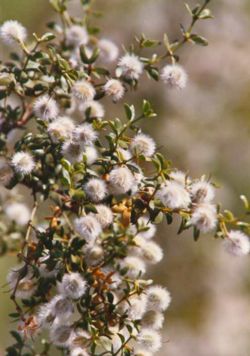
For those who haven't seen a creosote bush: it's approximately five feet tall with a very small, wax-coated shiny leaf. The waxy coating helps the plant retain moisture rather than losing it through transpiration. If conditions are favorable the plant produces a small but colorful bright yellow flower, followed by a white furry-coated seed pod.
There are a couple of remarkable things about the creosote bush. First, it is the most widespread plant in the Sonoran Desert, able to survive with the least amount of water in the poorest soil of any plant in this part of the world. Second — and more remarkable — scientists now believe the creosote bush may be the oldest continuously living plant on earth. For many years the Redwood or Sequoia was thought to be the oldest, then the Bristlecone Pine. The theory about the creosote bush is based on the idea that many plants arranged in a circular form share a central root system, with that common root possibly extending outward for several hundred feet. Some of those root systems are thought to have been on earth long before the appearance of Christ.
We finally make it to Quartzite and breathe a sigh of relief. Quartzite is a favorite wintering spot for snowbirds. During July the town has a population of a few hundred souls; during the winter months there are many thousands of campers. The Midwesterners stay because the climate is pleasant and it is the cheapest place around. There is absolutely nothing to do except rock-hound and possibly visit the Colorado River, 40 miles away.
Segment Four: Quartzite to Needles (90 miles)
Our next goal is Parker, Arizona, on the east bank of the Colorado River — time for a gas stop and walk-around inspection. When we leave Parker we cross the Colorado River and enter California. On the Arizona side near Parker there is a swath of irrigated land planted mostly in hay crops, making the area somewhat green and attractive. On the California side it is the most desolate country you will see — sand and not much else. I never fail to think of the poor Okies coming from Oklahoma headed for California and seeing this scene. It must have been heartbreaking.
After crossing the river the terrain is hilly for 20 miles until you reach Vidal Junction, where there is an agricultural inspection station. The inspection requires you to stop and answer two questions: where are you coming from, and do you have any fruit, plants, or animals? After answering over the roar of our generator — which is running to keep the roof air conditioners going — we are allowed to continue. Vidal to Needles is over a 1,500-foot hump with not many plants, though there is a sprinkling of Ocotillo, which can be colorful if it has rained recently.
All in all this leg isn't bad.
Segment Five: Needles to Barstow (145 miles)
The dreaded Needles-to-Barstow leg. This is 145 miles of no towns, no nothing. Exactly 100 miles from Needles is Ludlow — a town of 2 gas stations and one restaurant — and after that nothing until just before you reach Barstow.
As an aside: on our return trip to Tucson, Ludlow was the epicenter of an earthquake measuring 7.2 on the Richter scale. The quake was so severe it derailed a Santa Fe train and collapsed the freeway overpass connecting the two sides of town. We had passed through the town at about 6:00 p.m. and the quake hit at around midnight. We were asleep in the motor home at Needles and the quake woke us both up — it was felt as far away as Phoenix, 150 miles to the east. If you have never felt a major earthquake, it is an experience.
Just west of Needles is a 20-mile-long grade that raises some 2,000 feet in elevation. The last two miles are quite steep and it is a real chore for the motor home to get over with the car towed behind — especially when the temperature is 110 degrees or higher and a headwind is blowing at 20-plus miles per hour. Motor homes do not like headwinds. This is the leg I like the least.
That said, there are some points of interest. We are running parallel to the Santa Fe Railroad for part of the way, so we can watch a few trains pass. This is also the route John Charles Frémont took when returning from his second exploration trip to California — back through the San Joaquin Valley, over the Tehachapi Pass, then across the southwest desert to Saint Louis. Frémont chose this southern route for its warmer winter weather, though water for the animals was always the great challenge. The last reliable water heading east from California was at Newberry Springs, 20 miles east of Barstow. From there to the Colorado River was a two-to-three-day ride by horseback, and horses can't go three days without water — men can. Most explorers relied on Indian guides to find water and grazing fodder along the way. It's worth noting that Frémont was not looking for a settler's route to California — he was searching for a transcontinental railroad route to the west coast.
Another hazard faced by travelers crossing this part of the southwest was lava deposits — very hard on horses' feet even with proper shoes, and so widespread that going around them would have made reaching the next water hole impossible.
When we arrived at Daggett — 5 miles east of Barstow — we pulled into our favorite motor home park for the night with the good feeling that the worst was behind us. Josephine fixed us a nice supper, we watched some TV, and got a good night's sleep.
Segment Six: Barstow to Bakersfield
Friday. We feel better — the two hard legs are behind us and we're more than halfway. Just west of Barstow we get into more interesting country.
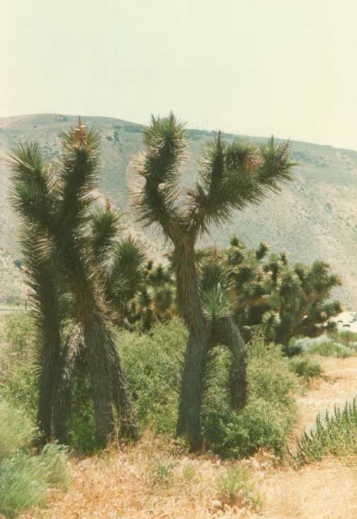
First we see an unusual tree — the Joshua tree. It's not pretty, just different. It looks a little like a Yucca plant but much larger, growing to a height of about 20 to 25 feet, with fibrous bark and long pointed leaves. This is the only place in the United States where this tree is found.
Next we pass Boron, California, where the Borax mines are located. Some of you will remember the tales of the 20-mule-team wagons shown on TV that hauled Borax to Los Angeles for processing into detergent products near the end of the last century. Now the product is carried by the Santa Fe Railroad.
Just after Boron we come to Edwards Air Force Base, where all the early testing of the space flight program was done. Chuck Yeager — the first man to break the sound barrier — did all his testing at Edwards. The plane Chuck flew was a rocket-powered craft carried aloft in the bomb bay of a B-29 Super Fortress. The small plane would be dropped from the bomber, the engine ignited, and the plane would accelerate to the desired test speed. The powered segment of the flight lasted only seconds before the fuel was exhausted. All of the early flights to test the Space Shuttle were also done at Edwards — and as you may remember, the shuttle always landed at Edwards and was then ferried on the back of a Boeing 747 back to Cape Canaveral.
Just past Edwards is Mojave, where the plane that flew around the world non-stop without refueling was built, tested, and returned to after its successful flight. That is a marvelous story about the courage of both the builder and the two pilots.
Then comes California City, whose existence is dependent on Edwards. Most of the people who work at Edwards live here. Twenty years ago when I first saw California City it was a treeless, uninviting little place — now it has trees, a golf course, a nice city park, traffic lights, strip malls, and everything other small cities have. Better looking? Yes. Better overall? Hard to say. This is also home to the Desert Tortoise, which is on the endangered species list in California though not in Arizona.
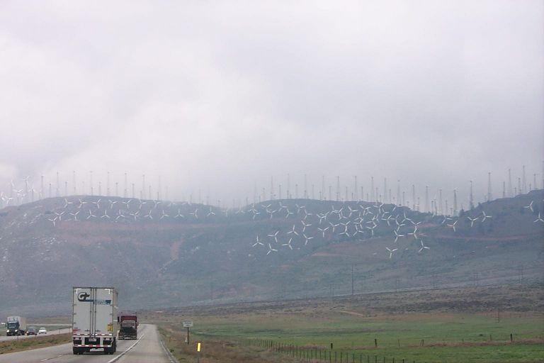
As we leave Mojave we travel through a mountain pass lined with hundreds of wind-powered electrical generators. These machines have gained some popularity over the years, though their existence has been largely due to government subsidy rather than economic profitability on their own.
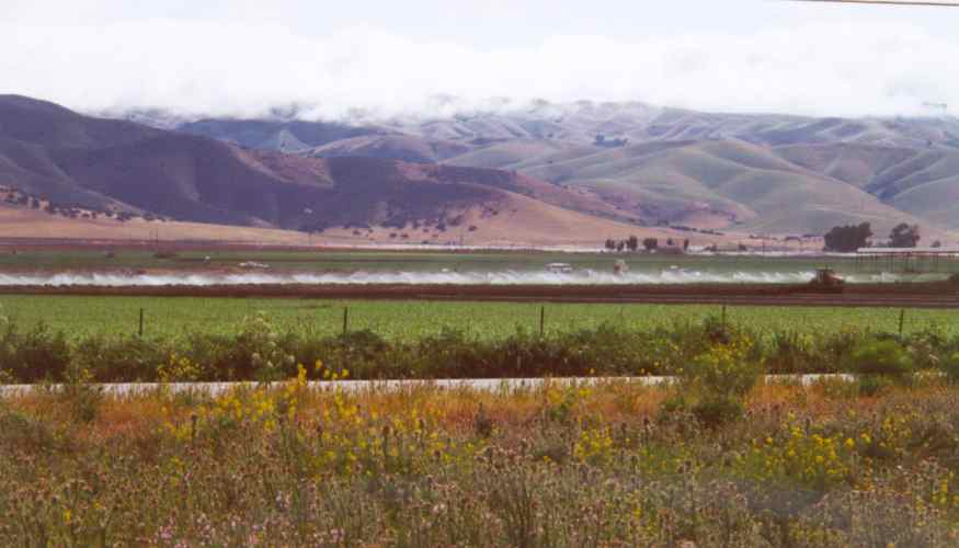
Just after the wind generators we enter the beautiful oak-studded mountains covered with golden-colored grass — this is the California I have come to see. California has gotten an unusual amount of rain the past few years and all of the natural vegetation is very healthy looking. We just need to proceed through the mountains for 25 more miles and we'll be in Bakersfield — home of Merle Haggard and Buck Owens — and the southern end of the San Joaquin Valley, one of the world's most productive farming areas, thanks to irrigation water.
As we come down out of the mountains we are given a grand view of the farming lands below. We pass through fields of citrus trees recently harvested, then fields of grapes in the middle of their harvest. Semi-trucks loaded with produce — mostly carrots, grapes, and garlic — are everywhere. We leave Bakersfield on Highway 99 and notice a dramatic increase in truck traffic.
The Final Leg: Bakersfield to San Juan Bautista
Twenty miles north of Bakersfield we leave Highway 99 and head west on secondary Highway 46. The first town is Wasco — the rose capital of the world.
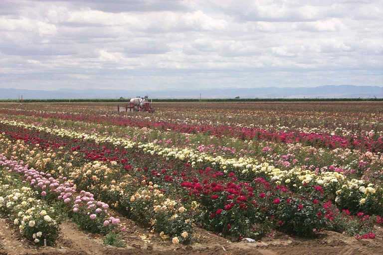
Just before Wasco we pass through fields of roses as far as the eye can see — all colors, and beautiful. Next are miles of pistachio orchards, then miles of almond orchards, then more grape vineyards. We will pass through 60 or more miles of grapes on this route; if we were traveling north on Highway 99 it would be 100 or more miles. This is the land of the Gallo Brothers, who used to produce cheap wine in gallon containers from grapes grown in this hot land. Now the same company produces premium wines in small, nicely labeled bottles at a hefty price, thanks to increased demand and improved winemaking techniques.
We are now on Highway 101 just north of San Luis Obispo. This is where the temperature becomes cool enough to turn off the air conditioner, open the windows, and relax. We've just about made it — the rest is beautiful. The Southern Pacific Railroad runs just to the right of the highway and will parallel us all the way to San Juan Bautista. This is my old stomping ground from my working years in California — I knew this territory from here to northern California as well as anyone. I knew every main road and most of the back roads.
We reach the lower end of the Salinas Valley just after joining Highway 101.